Around the World
-
Description
The object of the game is to be the first player to reach his or her destination city, by strategically combining amounts of latitude and longitude degrees to traverse the map from his or her starting city.
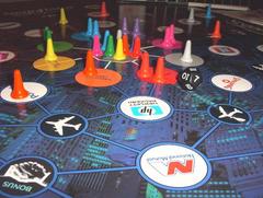
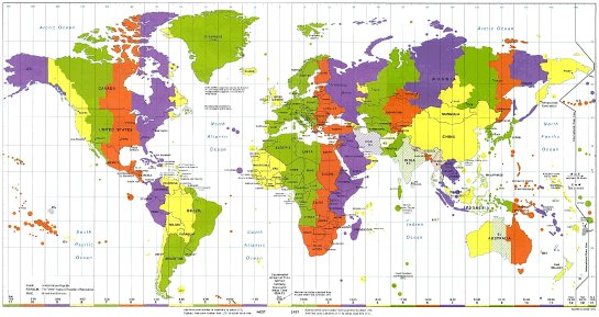
The game board is a map of the world, measuring approximately 16" by 25"
The board includes latitude and longitude lines at 15° intervals. In addition, the world’s time zones are marked along the bottom of the board with different colors, and each country is shaded with the color corresponding to the time zone that it respects. Finally, the International Date Line is depicted on the right-hand side of the board.
Each city represented by a card in the City Cards deck is marked on the board with a red dot, with the name of the city, the country in which it is located, and its coordinates printed next to it, for convenient reference by the players. An example is shown below:
closeup of Reykjavik and its coordinates on the game board
Player PiecesThere are four player pieces, colored red, yellow, green, and blue, so that up to four players can take part in the game.
Spinner
The players use the spinner to determine which type of card they must draw at the beginning of each turn. The three types of cards are Latitude, Longitude, and Wild Cards, as depicted on the diagram of the spinner below:
the spinnerThis design should be printed on a circle of card, and a plastic or metal arrow should be attached to the center, so that it can spin freely. The players spin by flicking the arrow and looking to see where it points when it has stopped spinning.
Deck of City Cards
There is one deck of City Cards, with one card representing each city marked on the map that players can land on.
As can be seen above, each City Card also displays the name of the city with which the main city is paired; this additional city is the player’s destination city, while the main city is his or her starting city for the game.
The country, latitude and longitude coordinates, and destination city for each city represented in the City Cards deck can be seen here (this information is for the game developer only; the players simply use the information printed on the board and cards).
Wild CardsThere is one deck of Wild Cards, which present situations that affect the players by creating obstacles to their movement (e.g. canceled flights), or by allowing them greater flexibility in their travels (e.g. a free flight to anywhere within 30° longitude). In addition, certain Wild Cards allow the players to travel “for free” if they correctly answer questions related to time zones.
Latitude and Longitude Cards
There are one deck each of Latitude Cards and Longitude Cards. The players collect and combine these cards in order to accrue degrees of latitude and longitude, which they subsequently use to make “journeys” to different cities on the board en route to their destination cities.
Scratch Paper and Pencils
Because the players will need to make frequent mathematical calculations in order to determine the number of degrees of latitude and longitude that they possess or require, the game provides scratch paper and pencils that the players can use to make these calculations.
Time RequiredThe game takes approximately 30 to 45 minutes, depending on the number of players. The fewer the players, the faster the game.
-
Details
Ages: 8 and upMechanics: Roll / Spin and MovePublisher: (Unpublished), (Web published)Time: 45 minutesYear: 2004

